
Trace Ardmore Street Directory Records
A street-by-street search in Ardmore works best as a chain, not as one broad name search. The Ardmore street index and mapping tools establish the road and its direction. The Carter County Assessor ties an Ardmore address to a tax parcel, while the recorder connects that parcel’s legal description to instruments. Older sources can add a household or business clue, but each one must stay labeled by its date and record type.
Ownership, mailing, and occupancy are separate claims. A tax-roll owner may not receive mail at an Ardmore property, and a recorded grantee may not have lived there. This address order keeps those differences visible and is helpful when an Ardmore address has changed format or another road has a similar name in a different quadrant.
An Ardmore address trail is strongest when the Ardmore street wording, Ardmore parcel ID, source date, and record purpose remain together in the search notes.
- Confirm the full Ardmore address and directional suffix with postal and official street-index wording.
- Use the Ardmore street index and GIS viewer to identify the map sheet, parcel, subdivision, and lot or block.
- Search the Carter County Assessor for an Ardmore property by address, owner, subdivision, or parcel components, then save the tax year returned.
- Search recorded instruments by party, addition, block, lot, or legal description to locate the Ardmore land trail.
- For an earlier Ardmore household clue, compare the year with Polk street material, newspapers, yearbooks, or obituaries.
Note: Keep a separate source-and-date line for every owner, taxpayer, mailing address, and historical occupant entry.
Ardmore Street Grid and Directions
The official Ardmore Street Index pairs street names with mapbook pages and grid references. It includes 12th Ave NW, E Main, I St SW, N St SW, Rockford Ct, and US Hwy 70. Those examples show why the suffix is part of the address. NW, NE, SW, and SE can distinguish records that otherwise look almost identical.
The full Ardmore city map supplies the wider road context, while the index works as a map key. Start there before treating a spelling variation or missing direction as a different Ardmore property. Oklahoma NG911 standards also recognize legacy street names and address-range fields, which can reconcile older wording without inventing a documented citywide renumbering history.
Carter County GIS Mapping links Ardmore-area land-record, court, and mapping routes. Its landing page is an Ardmore access map, not a public list of people along a street.
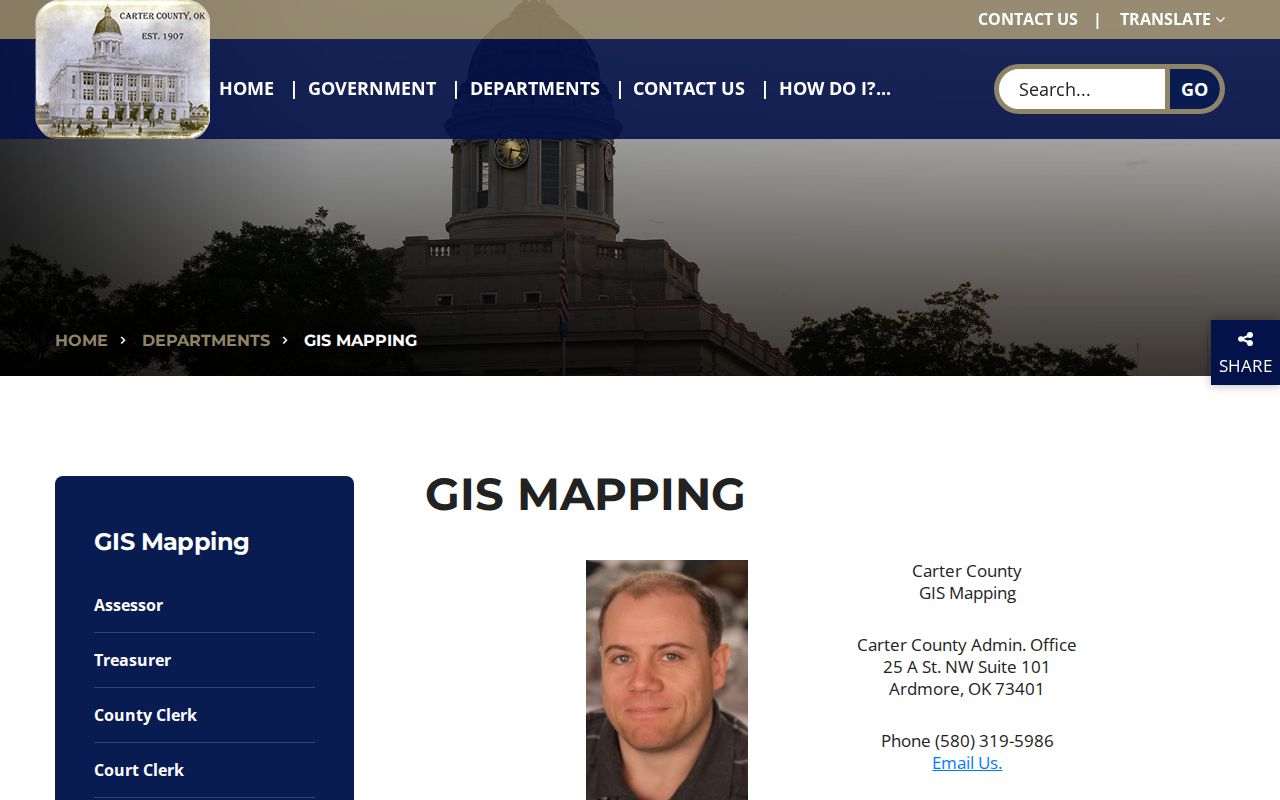
The Ardmore GIS landing view helps select the right mapping route before a parcel is compared with a deed or tax record.
Search Ardmore Street Directory Parcels
The Carter County Assessor property search is the current-property step in the address workflow. Its basic search accepts a property address, owner name, or parcel ID. Address text can be entered without a street number, which helps when checking a road, but a precise number should be added before treating a result as the right parcel.
The direct page returned a 403 during automated research, so confirm current labels and each selected result at the official office or live portal. The interface fields captured in research still explain how an address becomes a county parcel record.
| Assessor field | Input | Address-search use |
|---|---|---|
| Property Address | Optional text | Searches an Ardmore address or street wording. |
| Owner / Subdivision | Optional text | Refines a common Ardmore street or identifies a platted area. |
| Control Map / Group / Parcel | Separate text parts | Uses the tax identifier after an Ardmore parcel is located. |
| Classification / Sale Date | Optional filters | Narrows results that otherwise resemble one another. |
| Sort By | Selected order | Offers owner, property address, parcel ID, subdivision, class, or sale date. |
A parcel is the tax or map unit for land. The situs address is its physical address, while a legal description identifies it in a recorded instrument. Neither label alone proves who was there on a particular date.
Read Ardmore Address Tax Fields
The separate Carter County tax-roll search accepts business or owner name, last name, first name, a tax-year range, and an unpaid-tax option. Results list year, tax ID, owner name, property ID, type, base tax, total due, and payment. This makes it a current Ardmore tax identity check after the street and parcel are known.
Do not turn that tax record into an Ardmore deed chain. It can differ from the most recent recorded transfer, and its current data does not establish a historic Ardmore household. Read it beside the assessor parcel fields and the recorder’s instrument metadata.
The Carter County tax-roll screen shows the county’s available search controls and result columns.
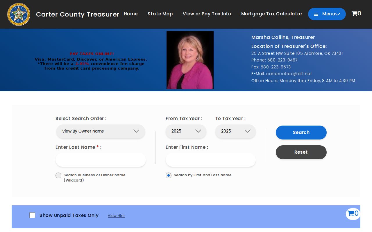
This Ardmore view supports a current tax check, not a conclusion about every resident or prior owner on the road.
Ardmore Street Records by Address
Ardmore’s address records are divided by custodian. An Ardmore street name is useful across the layers, but the parcel ID, legal description, or time period often does the real matching work. Use this Ardmore routing table instead of expecting one source to reveal the same information as another.
| Address record | Keeper | Signal from record | Access route |
|---|---|---|---|
| Assessor tax roll | Carter County Assessor | Ardmore owner, property address, parcel, subdivision, class, and sale date | ACT DataScout field search |
| Parcel and map layers | Ardmore and Carter County GIS | Situs location, geometry, plat, zoning, utility, and development context | Public viewer landing pages |
| Recorded instruments | Carter County Clerk | Ardmore parties, book/page, recording date, legal description, and instrument type | OKCountyRecords index and clerk route |
| Permit and planning files | Ardmore Community Development | Project, planning, code, or plat context | Department request by address and date range |
| Historic directories | Ardmore Library and OHS | Year-specific householder or business clues | Library and research-center collections |
The Oklahoma Voter Portal requires first name, last name, and date of birth for an individual lookup. It is not a public blockwide roster, and protected or ACP addresses are omitted from eligible voter-file access. It should not be used to fill in a street’s households.
Carter Deeds Along Ardmore Streets
OKCountyRecords Carter search has a basic party-name search and advanced fields for party type, book, page, series, instrument number, type, recorded dates, legal description, Quarter Quarter, section, township, range, addition, block, and lot. An Ardmore street address may not appear in a recorded description. Addition, block, lot, or the prior instrument may be the safer bridge.
In an Ardmore deed chain, the grantor transfers an interest and the grantee receives it. Search the current instrument, record its legal description and prior reference, then find the earlier deed through the same description or parties. Keep mortgages and releases apart from transfers so a financing record is not mistaken for ownership.
- Parcel
- A tax or mapping unit used by the assessor and GIS to identify land.
- Situs address
- The physical address of property, which may differ from an owner mailing address.
- Plat
- A recorded map dividing land into blocks, lots, streets, or easements.
- Criss-cross directory
- An address-to-name directory format; no named Ardmore run was verified, so ask the Library or OHS desk.
Note: The clerk portal says its indexed data begins in November 1998, while its scanned images begin in January 1908.
Ardmore Deed Index Numbers
The Carter County Clerk portal describes 7,588 books, scanned images beginning in January 1908, and name-indexed data beginning in November 1998. Those numbers explain the two stages of many street-directory searches. A recent name or instrument search may start online, while earlier material can require a book, image, clerk, or historical-research follow-up.
They do not prove every instrument from the image period is fully indexed or online. For a copy or certification question, distinguish the recording fee, copy charge, certification charge, and any portal image-plan charge. The clerk portal lists book lists, plat maps, fees, and land-record services.
This date split matters when an old Ardmore number fails to resolve online. Preserve the legal description and book/page reference, then ask the clerk or Library where the next record trail is held.
The Carter County Clerk is the local custodian for recorded land material, including deeds, mortgages, assignments, releases, liens, plats, easements, and related filings. An Ardmore request that gives the party name, instrument or book/page reference, legal description, and approximate recording date is more useful than a request for every record on a street. The clerk’s portal lists Kelly Brawley, a P.O. Box 1236 address in Ardmore, a 580-223-8162 phone number, and hours of 8–4. Confirm access arrangements and final fees with the office because a portal index, a scanned image, and a certified copy are different access products.
Ardmore Address Permit Files
Ardmore Community Development handles inspections, code enforcement, planning, subdivision plats, rezoning, and conditional-use matters. Those files can add address-specific project context. Request a specific permit, application, or code record with the exact street address and a date range.
A permit or code file is project evidence, not a resident roll. Applicant and owner details can be redacted or have separate privacy rules. The city’s materials list final and preliminary plats, variances, home occupations, rezoning, and related forms, which can help identify the correct request.
The Community Development office page identifies the department that routes these address-related files.
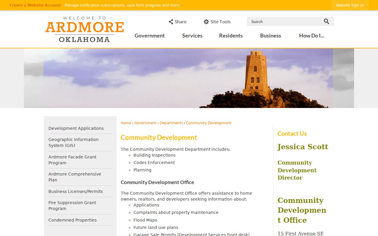
The department landing page is a practical start when an address trail needs permit, planning, or code context.
Note: An Ardmore permit or planning file can provide project context, but no public address-searchable permit or code index was verified.
Ardmore Street Development Applications
The Ardmore Development Applications page separates forms by project type and provides a detailed fee schedule. A precise address, parcel description, and date can narrow a request for a final plat, minor subdivision, rezoning, variance, or permit-related record. This is useful when a street changed through a plat or development action.
The Ardmore applications page does not replace a parcel or deed search. Match an Ardmore project file back to the assessor parcel, GIS layer, and recorded plat before drawing a property conclusion. Keep directional suffixes and lot/block wording exactly as each source gives them.
The development-applications page shows the city’s forms and fee categories.
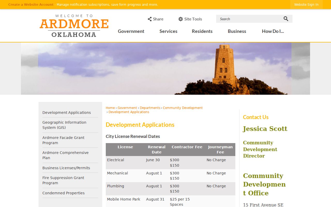
The Ardmore form categories help name the right record rather than make an unbounded address request.
Historic Ardmore Street Residents
For a past street listing, the verified R.L. Polk Ardmore City Directory run covers 1904 through 1960. Its street and householder material is the strongest documented local address-to-person bridge. It is an annual snapshot, not proof of a deed holder or a full census of the block.
The 1922 directory notice describes a 62-page street and avenue guide with householders. Ardmore Public Library also points researchers to yearbooks, cemetery names, local funeral-home obituaries, newspapers, and local-history collections. Compare the nearest directory year with a deed date or map, rather than reading a single entry as a continuous record.
When the question shifts to historical collection holdings, the verified materials are described on the Ardmore city directory page.
Ardmore Street Directory Limits
No single public Ardmore collection establishes every person at every address. Utility customer details are confidential, and school-zone enrollment records are not a street-search source. A parcel map shows land geometry, not a social relationship. A directory entry, tax record, postal delivery point, and deed each carry a different kind of evidence.
Oklahoma’s Address Confidentiality Program and voter Restricted Records can shield qualifying addresses. The Oklahoma Open Records Act governs access, but records also have specific confidentiality rules and redactions. Ask the right custodian for a specific record, and do not try to infer a protected location from other sources.
Lawful use. Ardmore street records are for careful personal, civic, family-history, and property research. Do not use address information to stalk, harass, intimidate, threaten, or harm another person.
Note: If a street name or number fails to match, preserve the source wording and check GIS, legal-description, and legacy-address fields.